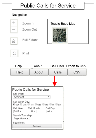
Public Calls for Service (mobile)
Disclaimer
Development Log
These layers do not represent a survey. No Accuracy is assumed for the
data delineated herein, either expressed or implied by Kane County or
its employees. This map may contain inaccuracies or typographical errors.
Information may be changed or updated without notice and is provided
as-is without warranty of any kind, either expressed or implied, including
(without limitation) implied warranties of merchantability or fitness for a
particular purpose.
01/19/2023 Added 2023, 2024, 2025, 2026, 2027 to drop down list
01/20/2022 Adjusted ArcGIS Javascript API from 4.21 to 4.22
01/20/2022 Added 2022 to Drop Down List
10/07/2021 Adjusted ArcGIS Javascript API from 4.17 to 4.21
01/08/2021 Added 2021 to Drop Down List
10/14/2020 Adjusted to new server along with adding SSL
01/06/2020 Added 2020 to Drop Down List
06/17/2019 Software Release Life Cycle - Release (live)
06/14/2019 Created mobile Public Calls for Service Dashboard
06/15/2019 Software Release (full size) Life Cycle - Release (live)
06/12/2019 Adjust Sex Offense to sex offender contact
06/12/2019 Adjusted minScale from 18055.954822 to 36111.909643
06/06/2019 Consolidated CallTypes
06/06/2019 Added View Contraint maxScale: 577790.554289
06/06/2019 Added View Contraint minScale: 9027.977411
06/06/2019 Added View Contraint rotationEnabled: false
06/04/2019 Software Release Life Cycle - Release
06/03/2019 Software Release Life Cycle - Beta
05/29/2019 Began re-write based on new database tables
05/29/2019 Received new database tables
05/10/2019 Added Disclaimer
05/09/2019 Added Export Table to CSV function - tested IE/Chrome/FF
05/10/2019 Need unuasable fields in data to be adjusted
05/03/2019 Started calculations of Twp and location adjustments
05/03/2019 Received initial 2019 Calls for Service data(draft)
05/01/2019 Calculate Twp and slide location off of exact location
05/01/2019 Work with ITD to get current data for new dashboard
04/29/2019 Given the go ahead to move forward with re-activation
04/23/2019 Shared draft version with Sheriffs Office
02/25/2019 Designed to mimic Esri Dashboard & Day and Night Mode
02/25/2019 Began re-development of 2008 Incident Tracker
02/25/2019 Asked to re-activate Public Calls for Service web app
