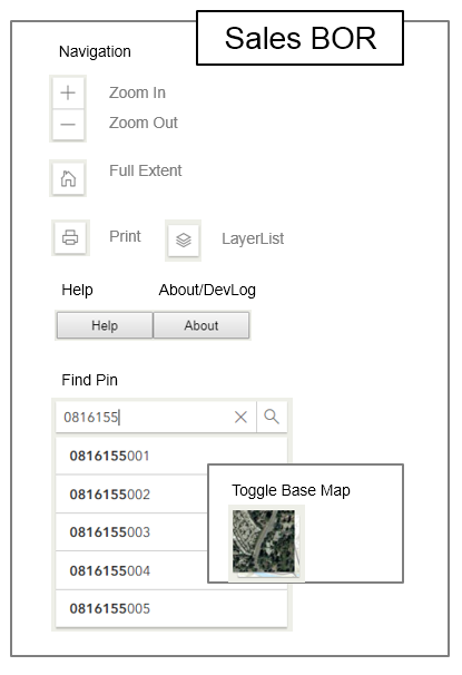
Sales BOR Web Application
About
Disclaimer
Develpment Log
This PublicGIS map viewer was created by GIS-Technologies a division of
the Information Technologies department as a replacecment for the original
Sales BOR web Application using the new ArcGIS Javascript API 4.x library.
These layers do not represent a survey. No Accuracy is assumed for the data
delineated herein, either expressed or implied by Kane County or its employees.
These layers are compiled from official records, including plats, surveys,
recorded deeds, and contracts, and only contains information required for local
government purposes. See the recorded documents for more detailed legal
information.
11/04/2024 Updated Wedge link to add year 2023
08/07/2024 Updated to new AddresPoints (06N202 --> 6N202)
11/07/2024 Upgraded to ArcGIS Maps SDK for JavaScript 4.31
07/01/2024 Upgraded to ArcGIS Maps SDK for JavaScript 4.30
01/05/2024 Upgraded to ArcGIS Maps SDK for JavaScript 4.28
07/06/2023 Added .esri-popup__main-container height: 192px; per 4.27
07/06/2023 Added .esri-view .esri-view-surface--touch-none:focus::after{outline: none !important;} per 4.27
07/06/2023 Upgraded to ArcGIS Maps SDK for JavaScript 4.27 (release)
03/02/2023 Upgraded to ArcGIS Maps SDK for JavaScript 4.26 (release)
07/11/2022 Upgraded to ArcGIS API for JavaScript 4.25 (release)
07/11/2022 Added highlightPinLayer
07/11/2022 Upgraded to ArcGIS API for JavaScript 4.24 (release)
12/08/2020 Adjusted wedge to https
10/03/2018 Adjusted sSize>100000 view.goto scale:7000 else view.goto scale:900
09/28/2018 Upgraded to ArcGIS API for JavaScript 4.9 (release)
09/26/2018 Removed adjustment for web mercator Acres calculations per esri ArcGIS Online changes
08/11/2018 Changed DevLog dialog background color to white
08/11/2018 Added Help Button
08/11/2018 Added About Button (DevLog)
08/11/2018 Added Disclaimer to Print widget
08/11/2018 Unchecked Legend on Print widget
08/11/2018 Adjusted extent of Map to fit browse size
08/08/2018 Set labelsVisible property to true in order to print labels
08/08/2018 Added Print widget
08/05/2018 Adjusted searchWidget to zoomScale:2000
08/03/2018 Restricted layers
07/27/2018 Resize popup using .esri-popup__main-container style
07/26/2018 2018 Aerials Activated in Basemap Imagery
07/26/2018 Added DevLog dialog
07/26/2018 Changed basemap from topo to topo-vector
07/25/2018 Added display of SaleAmt3/Year3 based on SaleCnt3
07/25/2018 Added display of SaleAmt2/Year2 based on SaleCnt2
07/25/2018 Added display of SaleAmt1/Year1 based on SaleCnt1
07/24/2018 Added searchWidget.search(sPin); in view.when function
07/23/2018 Added search widget
07/23/2018 Added Conversion widget
07/23/2018 Added BaseMap Toggle widget (topo/satelite)
07/23/2018 Added Home widget
07/23/2018 Configured Webgl
07/23/2018 Begin re-write of TaxMap.html (3.11) to TaxMap.html (4.8)
07/23/2018 Adjusted display of parcel_dmz polygons
07/23/2018 Adjusted display of sales_bor_dmz polygons
07/23/2018 Adjusted display of township_dmz polygons
07/20/2018 Optimize parcels_dmz weekly
07/20/2018 Update parcels_dmz weekly
07/20/2018 Update sales_bor_dmz same time as KaneGIS
07/20/2018 Update township_dmz static
07/20/2018 Loaded parcels_dmz, sales_bor_dmz, townshp_dmz into ArcGIS Online
